
Hot Days Are Here (D-71: 1427.8 - 1458.1, D-72: 1458.1 - 1489.4)


The whole country is baking from the one headline I read a few days ago. And so are the hikers on the PCT. And unlike the desert, even the wind is not cool. It helps, when it occasionally blows, but only a little. And, now the nights are also not cold. Cooler definitely and quite pleasant, but not cold. No need for a sleeping bag or quilt to cover up. To beat the heat, started the hike yesterday and today at 4 am to get as many miles in as possible before the sun comes out in full force. Luckily big chunks of the trail these two days were under the canopy of trees, and that helps. Today the water sources were much more numerous and spread out, unlike yesterday when there were only a few and pretty much all of them were off-trail, which meant walking some distance to the creek or stream.  

Some creeks like this were under bushes & difficult to access

All water sources have cold water, though by the time one filters it, it has warmed up a bit. Another big issue are the mosquitoes and bugs around water sources and at the campsite (even those far away from water) in the evening. Hundreds of them. Very irritating and I get inside the tent as soon as it set up. Tent is a good protection from these pesky things!

Ok... enough complaining. Just smack me in the head if I ever complain about heat when I am at home with access to a fan and some cold water/pop and don't even need to carry a 35 lb bag on my back! 😬🙂

Today crossed two big water sources - McCloud river and Squaw Creek. Collected water and lay down in the cold water to cool down and to clean up in the latter! That was really nice. One of the advantages of hiking in the wilderness 🙂.

   McCloud River

Yesterday in the middle of the hot afternoon, I came across a patch of leftover snow - that was like winning a small lottery. Sat on it, collected some cold water from it and washed my face with the cold snow.

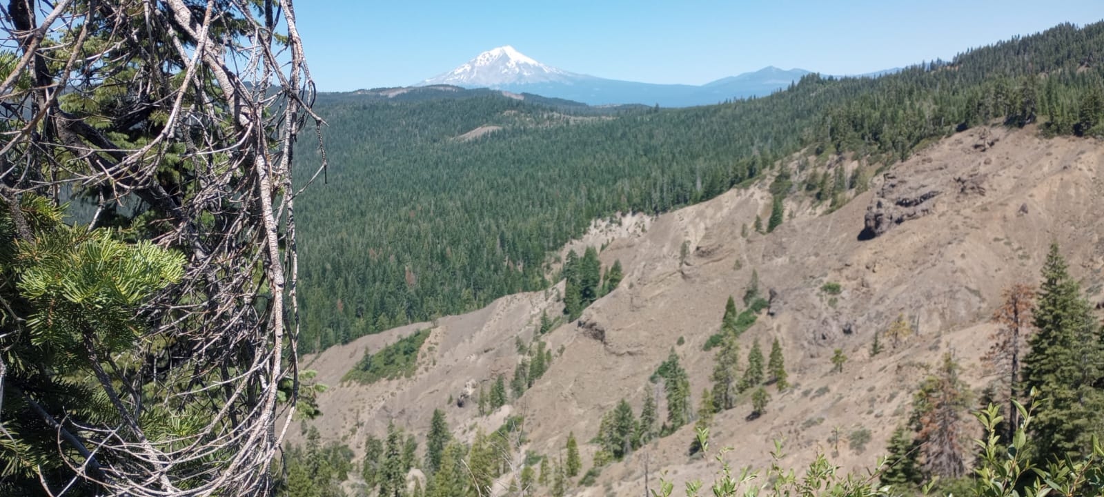
Also continued seeing Mt Shasta in the far off distance while hiking.

Encountered a fearless deer at the campsite last night. It came close to the three tents and was not at all perturbed by the people around. Kept all my food and hiking poles inside the tent, just to prevent them from being chewed upon.

My tent on the left and the deer on the right. (link to deer video)

Data:
D-70
D-71: 

Comments

Popular posts from this blog

My gear and my tramily (D-97 @ 2148 - Zero day)

Some of you have asked about what gear I am using. Since today is a Zero day (the last Zero day was on D-57) and there is nothing much to report other than the fact that I shipped the last set of resupply boxes to different places in Washington state and ate substantial amounts of food today, I figured I might as well talk about my gear, and also a bit about the other most essential component on the hike - my "tramily" (trail-family).   Tent : 1-person Rainbow Li from Tarptent (bought new). This has worked very well for me and as you know from my earlier posts, Tarptent has given very good customer service too. I haven't had the chance to use the tent in heavy rain or snow (luckily) though and can't comment on it. I use a Tyvek ground sheet (already owned), also from Tarptent. Backpack : Catalyst from ULA (already owned).  I started with Zpack Arc Air Robic 60L (bought new) and used it for 700 miles, but it was not comfortable at...

Monthly Data Update (M-4; Day 91 to 118)

  All data below in italics is for M-1, M-2 & M-3 respectively, for comparison. M-4 is 28 days (all other months were 30 days) Distance traveled on PCT: 702 mi / 1130 km   ( 631 mi / 1015 km; 554 mi / 892 km; 798 mi /1284 km ) Total time: 281 ( 280; 280; 320 ) hours Total ascent:  126,923 ft / 38,686 m ( 117,830 ft/35,915 m; 99,040 ft/30,190 m; 123,951 ft/37,780 m )  Total descent: 128,161 ft / 39,063 m  ( 115,912 ft/35,330 m; 99,730 ft/30,400 m; 123,921 ft/37,771 m ) Highest point: 7174 ft / 2187 m ( 9407 ft/2867 m; 13,120 ft/4000 m; 7580 ft/2310 m ) Average distance/day: 25 mi / 40 km ( 21 mi/34 km; 18.7 mi/30.1 km; 26.6 mi/42.8 km )  Average distance/hiking day: 26 mi / 42 km ( 21.8 mi/35.1 km; 21.3 mi/34.3 km; 26.6 mi/42.8 km ) Average time hiking/day: 10.0 ( 9.3; 9.3;  10.7) hours (incl Nero days) Average pace: 2.6 mph/4.2 kmph ( 2.3 mph/3.6 kmph; 2.0 mph/3.2 kmph; 2.5 mph/4.0 kmph ) Number of Zero days:...

Gratitude (D-114: 2577.8 - 2592.1 - Nero @ Mazama)

As the last town day on the trail ends and a few dozen miles left to the end point, I would like to speak of gratitude. Every so often on the trail, there are moments of "why the heck am I doing this?" and that's when I have to compel myself to remember that this is an option and an opportunity given to me. I am fortunate enough to be able to hike on this trail for a long period, which is essentially a vacation (albeit, a physically & mentally demanding one). Not everybody gets the option of taking such a long vacation from work, family and other commitments. It may be a cliche, but I am full of gratitude for this. I am also deeply grateful to a bunch of people who made this hike possible and I would like to use this post to mention those people. Ravin & Deepika opened their home and hearts so that I could do all the preparatory work before the hike. They were generous to a fault and I used (& perhaps, abused) their generosity. Even during the hik...