
Water, Mosquitoes & Fire (D-47 924.5 - 948.3 & D-48 948.3 - 972.9)

Getting up and over Donahue Pass was relatively painless except for a few times I lost the trail among the intermittent snow fields on the way up and had to take help of the FarOut app to way-find. Essentially, I can follow the footsteps of previous hikers in the snow but as the snow is melting, some of these shoe prints go away and the trail is not always obvious. It is just a bit of inconvenience since your hands & fingers are cold in the morning and removing gloves, using the phone and then putting back the gloves is a pain. Quite a few recent mornings when I have camped at high elevation near snow, my thumbs and little finger are so cold and unfeeling in the morning after packing up the tent etc. that they are essentially useless and take time to thaw out 😏.

   Snow field leading up to Donahue Pass

At Donahue Pass (surprisingly none of the passes have any sign at the top with the name or details of the pass)

A very well marked trail on top of a rock....a very rare sight. Large flat rocks are another place where one loses the trail 'cos everything looks the same.

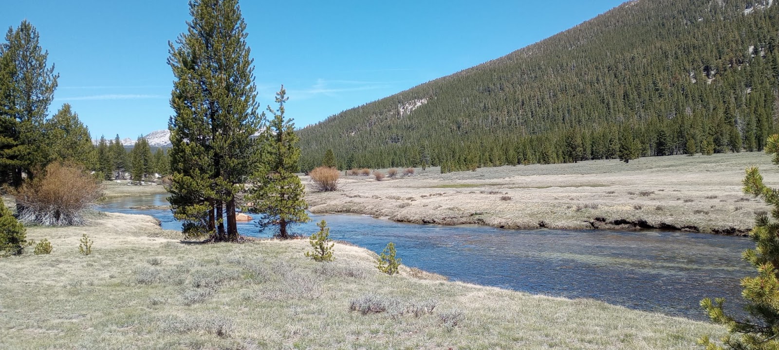
After Donahue Pass, it was a mostly flat trail going through the miles long Lyell Canyon before coming to Tolumne Meadows in Yosemite National Park.

Lyell Fork stream slowly flows through the Lyell Canyon

And now the mosquitoes started! Even if I stopped for a minute in Lyell Canyon, dozens of big mosquitoes would swarm all over. Lots of water and lots of stagnant water - both on and off the trail. The trail itself is a muddy bog in many places.

Finally, reached Tolumne Falls later in the evening and it was an impressive sight.

   (see the rainbow created by the mist) 

Another massive waterfall near the Glen Aulin campsite where I set up tent for the night.

Perhaps the most important part (that's how much hikers crave company) of the day was I met another hiker - Sofie - who was going at a somewhat similar pace and distance as I was, with long food carries in between resupply stops. She had started her hike close to when I had started too. That was great! We talked and figured we could at least meet up at the end of the day and maybe pass each other during the day to give ourselves some company. Yaaaaaay!

Today started out with going thru frost-covered grass meadows
followed by high alpine Miller Lake
and after a small sketchy snow-covered steep-ish descent, I saw a bear calmly strolling on the trail below 😀. It just walked on and went into the woods.

Then it was yet another slog through the snow fields to Dorothy Pass & beyond. The big part was the water crossings today which were innumerable and enough of them that my shoes, socks and feet stayed wet for most of the day.

However, the campsite we ended up at had a fire ring and for the first time on the trail, I had a fire to dry things and keep warm during dinner. And as importantly, keep away the annoying mosquitoes.

Of course, the fire was completely shut down and all embers doused in water from a nearby stream to ensure no accidents.

Data:
D-47
D-48

Comments

Popular posts from this blog

My gear and my tramily (D-97 @ 2148 - Zero day)

Some of you have asked about what gear I am using. Since today is a Zero day (the last Zero day was on D-57) and there is nothing much to report other than the fact that I shipped the last set of resupply boxes to different places in Washington state and ate substantial amounts of food today, I figured I might as well talk about my gear, and also a bit about the other most essential component on the hike - my "tramily" (trail-family).   Tent : 1-person Rainbow Li from Tarptent (bought new). This has worked very well for me and as you know from my earlier posts, Tarptent has given very good customer service too. I haven't had the chance to use the tent in heavy rain or snow (luckily) though and can't comment on it. I use a Tyvek ground sheet (already owned), also from Tarptent. Backpack : Catalyst from ULA (already owned).  I started with Zpack Arc Air Robic 60L (bought new) and used it for 700 miles, but it was not comfortable at...

Monthly Data Update (M-4; Day 91 to 118)

  All data below in italics is for M-1, M-2 & M-3 respectively, for comparison. M-4 is 28 days (all other months were 30 days) Distance traveled on PCT: 702 mi / 1130 km   ( 631 mi / 1015 km; 554 mi / 892 km; 798 mi /1284 km ) Total time: 281 ( 280; 280; 320 ) hours Total ascent:  126,923 ft / 38,686 m ( 117,830 ft/35,915 m; 99,040 ft/30,190 m; 123,951 ft/37,780 m )  Total descent: 128,161 ft / 39,063 m  ( 115,912 ft/35,330 m; 99,730 ft/30,400 m; 123,921 ft/37,771 m ) Highest point: 7174 ft / 2187 m ( 9407 ft/2867 m; 13,120 ft/4000 m; 7580 ft/2310 m ) Average distance/day: 25 mi / 40 km ( 21 mi/34 km; 18.7 mi/30.1 km; 26.6 mi/42.8 km )  Average distance/hiking day: 26 mi / 42 km ( 21.8 mi/35.1 km; 21.3 mi/34.3 km; 26.6 mi/42.8 km ) Average time hiking/day: 10.0 ( 9.3; 9.3;  10.7) hours (incl Nero days) Average pace: 2.6 mph/4.2 kmph ( 2.3 mph/3.6 kmph; 2.0 mph/3.2 kmph; 2.5 mph/4.0 kmph ) Number of Zero days:...

Pleasures of being on PCT (D-16; 303.7 - 328.8 miles)

Heading out from the cowboy camping experience last night, I was looking forward to Deer Creek Hot Springs that is apparently very popular among the locals too & tended to get crowded during the weekends, even though one has to hike in a mile or so from the trailhead parking (or hike 308 miles on PCT 🙂). Reached it early enough, but still it was chock full of people - locals & thru-hikers both - most of whom had camped there overnight in spite of it being a No Camping zone. People were lazing around in some of the pools in various states of undress, as it was a clothing optional area. It was way too crowded for me and I decided to head out. But, as I was heading out, I saw a small pool of water with nobody in it and the water was pleasantly hot (not just warm). Pool I "discovered" away from the crowds Close-up of the pool Me in the pool 😋 What a lovely feeling to be in a hot pool, especially after not having had a hot ...